REQUEST A TOUR If you would like to see this home without being there in person, select the "Virtual Tour" option and your agent will contact you to discuss available opportunities.
In-PersonVirtual Tour
$175,000
Est. payment /mo
50.3 Acres Lot
UPDATED:
12/10/2024 04:43 PM
Key Details
Property Type Vacant Land
Sub Type Acreage
Listing Status Active
Purchase Type For Sale
Municipality Grant Twp
MLS Listing ID 24055442
Annual Tax Amount $2,314
Tax Year 2023
Lot Size 50.300 Acres
Acres 50.3
Lot Dimensions Irregular
Property Description
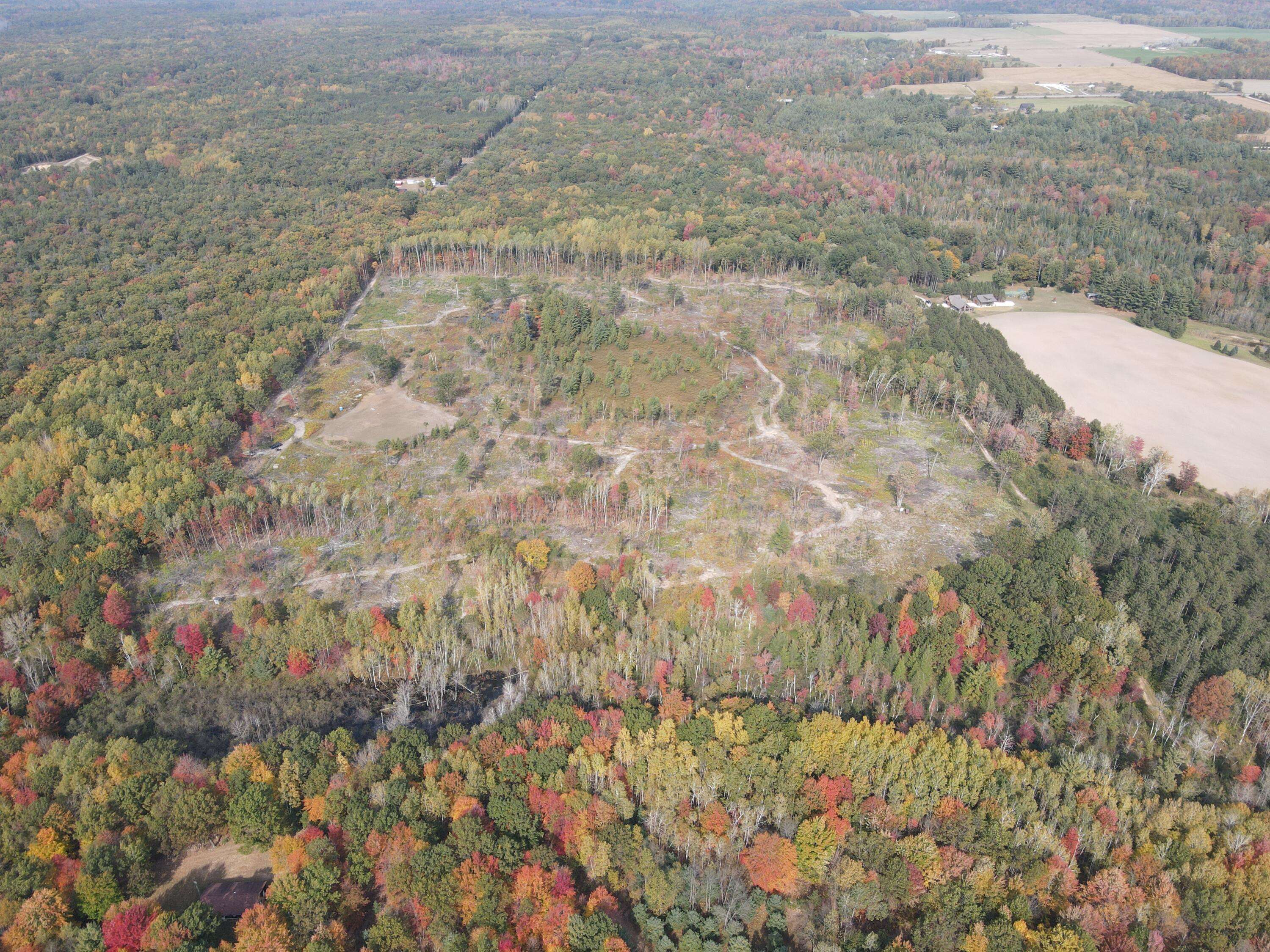
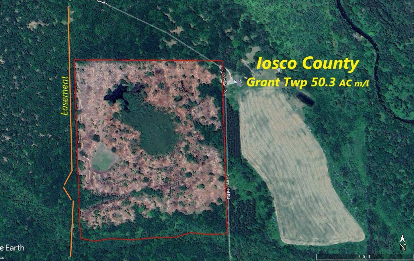
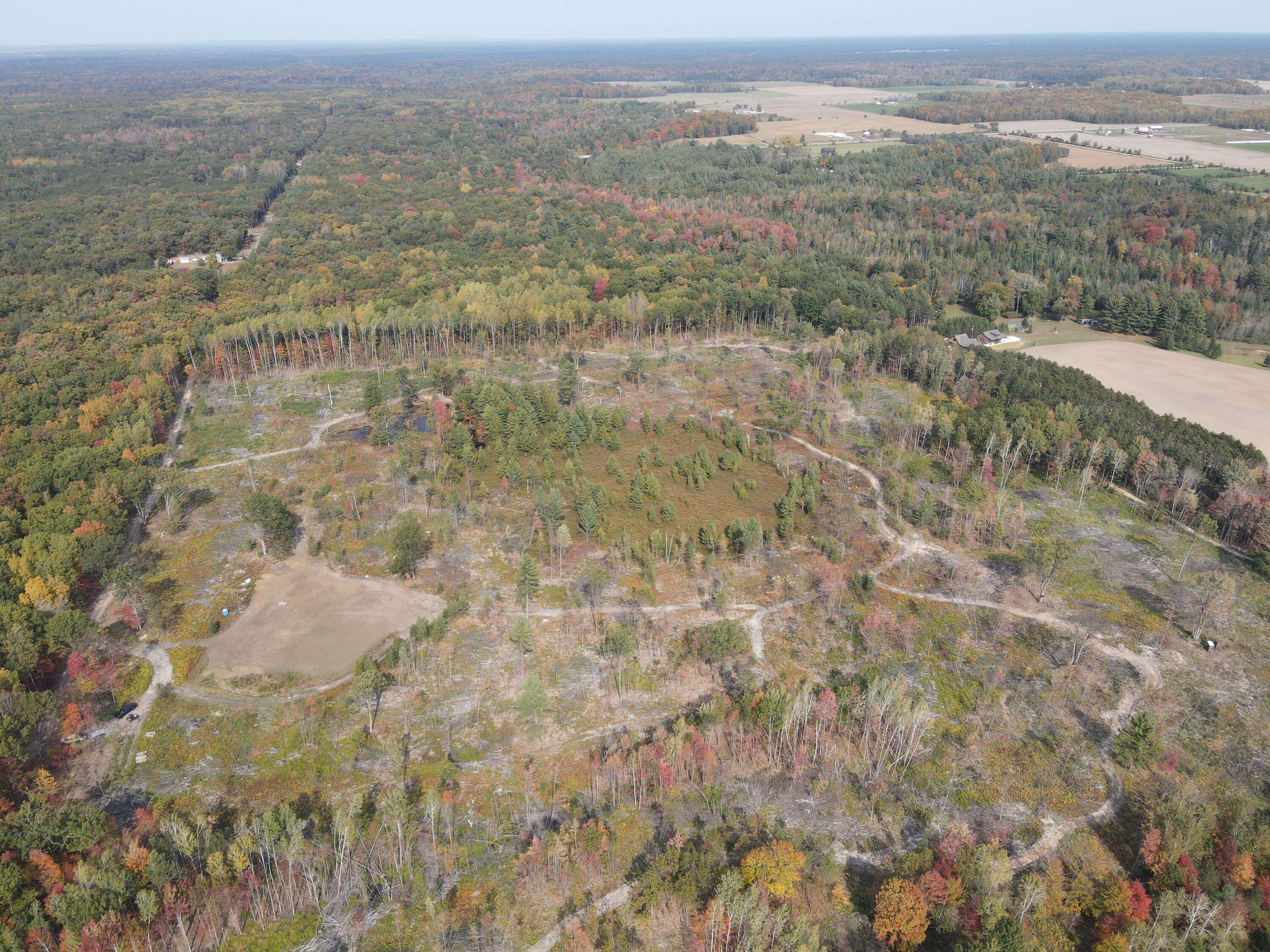
Located in Iosco County about 10 miles from downtown Tawas. This vacant property sits just south of M-55 on over 50 acres. The property has been enrolled in the Qualified Forest Program to keep taxes lower and was just recently select cut per the forestry plan. With the logging done, the habitat plan that was done by Jake Ehlinger of Habitat Solutions 360 can start being implemented. New access trails have already been added around the property and the fresh poplar regrowth is providing food and cover for the wildlife. A couple of box blinds are in place, there is a large established food plot on the west side of the property along with a small pond that does hold some ducks and the pines and brush that surround that serve as a great deer bedding area. The terrain starts to lose elevation on the southern border where there is a small creek that eventually dumps into the East Branch of the AuGres River. You might find an occasional walleye or salmon in this creek. Power can be accessed from the NE corner of the property and the main access is from an easement along the West side of the property. Dial the listing agent directly for more information. The "Contact Agent" button will not get you to anyone who knows anything about the property.
**Maps contained on our sites are there to simply depict the over all layout or shape of a given property and show what it looks like from an aerial view. These maps are neither a legally recorded map, or any type of a legal survey and should never be used as such. Also "Acreage" amounts are displayed as according to the information we have obtained through local government and are in no way guaranteed or warranted to be exact** The terrain starts to lose elevation on the southern border where there is a small creek that eventually dumps into the East Branch of the AuGres River. You might find an occasional walleye or salmon in this creek. Power can be accessed from the NE corner of the property and the main access is from an easement along the West side of the property. Dial the listing agent directly for more information. The "Contact Agent" button will not get you to anyone who knows anything about the property.
**Maps contained on our sites are there to simply depict the over all layout or shape of a given property and show what it looks like from an aerial view. These maps are neither a legally recorded map, or any type of a legal survey and should never be used as such. Also "Acreage" amounts are displayed as according to the information we have obtained through local government and are in no way guaranteed or warranted to be exact**
Location
State MI
County Iosco
Area Outside Michric Area - Z
Direction West on M-55 from Tawas then South on Imperial drive to the gate at the end of the road
Exterior
Utilities Available None
Waterfront Description Pond,Stream/Creek
View Y/N No
Present Use Recreational,Hunting
Street Surface Unimproved
Building
Lot Description Rolling Hills, Cleared, Recreational, Wetland Area, Wooded
Schools
School District Tawas
Others
Tax ID 050-029-400-001-00
Acceptable Financing Cash, Conventional
Listing Terms Cash, Conventional
Read Less Info
Listed by Michigan Whitetail Properties


